Mostly the public. Lake Blue Ridge (TVA’s Blue Ridge Reservoir) in Fannin County, Georgia, is a Tennessee Valley Authority reservoir, and TVA says the Chattahoochee National Forest borders roughly 80 percent of its 65 miles of shoreline. The Forest Service’s listing on Recreation.gov puts the developed share at 25 percent. Whoever owns the land behind the water’s edge, TVA’s Section 26a rules decide what gets built there.
That split shapes almost everything about the lake: where you can launch and swim, why so much of the shore looks wild from a boat, and what a buyer is really getting with a “lakefront” lot. Here is who holds what, and what it means in practice.
Three owners, one lake
TVA: the water, the dam and the rules
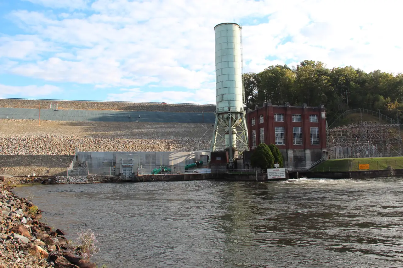
The Toccoa Electric Power Company, a subsidiary of the Tennessee Electric Power Company (TEPCO), built Blue Ridge Dam between 1925 and 1930. TVA bought the dam from TEPCO in 1939, according to TVA. TVA runs the reservoir today. It sets the seasonal guide curve the lake follows, operates the dam and issues the Section 26a permits required for work along the shoreline. TVA also describes the whole reservoir as lying within the Chattahoochee National Forest of north Georgia.
The Forest Service: most of the shore
The U.S. Forest Service manages the national forest land that makes up most of the shoreline, and it runs the lake’s public access points. Morganton Point Recreation Area is the only developed campground on the shoreline, per the USFS. Lake Blue Ridge Recreation Area, on the west side of the lake, is free and open year-round (USFS). Lakewood Landing Boat Launch, on the north side, is open sunrise to sunset and requires a launch pass.
Private owners: the developed share
The rest is private land: homes, docks, the privately run Lake Blue Ridge Marina and the lots between them. The Forest Service’s figure for that developed share is 25 percent. Owning a lot does not take its shoreline out of TVA’s reach. A new dock, shoreline stabilization or clearing vegetation on that land still runs through a TVA permit.
Why 80 percent and 25 percent don’t quite add up
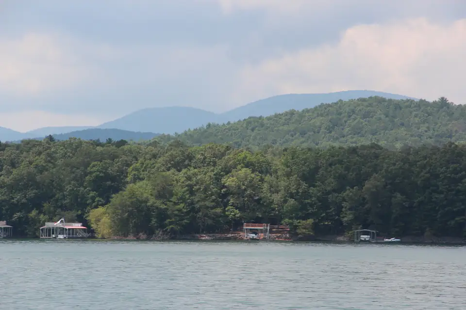
Read side by side, the two federal figures overlap: 80 percent forest plus 25 percent developed is 105 percent. Both agencies are rounding. TVA says the forest borders “roughly” 80 percent of the shore. The Forest Service says 25 percent is developed and “the balance” is national forest land, which works out closer to 75 percent. The fair summary is that roughly three-quarters to four-fifths of Lake Blue Ridge’s shoreline is national forest and about a quarter is developed. We print both numbers with their sources rather than pick one.
What it means if you are visiting
Because so much of the shore is public forest, the main ways onto the water are Forest Service sites, plus one private marina. A few things follow from the agencies’ own pages:
- Swimming: Morganton Point has the one designated swimming area the Forest Service lists on the lake. Lakewood Landing prohibits swimming from its dock and ramp. Our swimming guide has the details.
- Launching: the Forest Service launches and the private marina are on our boating page, with fees and passes as each operator lists them.
- Camping: Morganton Point is the only developed campground on the shore. See our camping page.
- Site rules: on national forest land, the Forest Service sets the rules for each site. Morganton Point, for example, allows no alcohol in its campground or day-use areas and requires dogs to be leashed at all times.
What it means if you are buying
For a buyer, the ownership question turns into three practical ones. None of them can be answered from listing photos.
Does the lot actually touch the water?
With most of the shore in national forest, plenty of land near the lake sits behind a strip of public forest rather than on the water itself. A lot that backs onto national forest along the shore is not, by itself, a lot with private frontage, whatever the view looks like. The survey and the deed answer this question.
Who owns the land at the water’s edge?
TVA’s rules describe two situations. Where TVA owns the shoreland, TVA says its permission is always required before any activity on TVA land, even activities that would otherwise be exempt. Where TVA holds only a flowage easement over the shoreland, the terms of that particular easement and the rest of 18 CFR 1304 govern how the land can be used, per TVA. Your title work should tell you which applies to the lot in front of you. If it doesn’t, ask TVA before you plan a dock.
How far up the bank do TVA’s rules reach?
On TVA reservoirs, 26a jurisdiction typically extends to the 500-year floodplain (the area with a 0.2 percent chance of flooding in any year) or to the upper limit of TVA’s land rights, whichever is higher. That can take in more of a lot than the strip you see from the water.
Inside that zone, building, changing or maintaining anything, including docks, shoreline stabilization and vegetation removal, needs a Section 26a permit. Residential docks and other water-use facilities are capped at a 1,000-square-foot total footprint (1,800 square feet in areas of preexisting development), and a new owner of land with a permitted dock must notify TVA within 60 days, per TVA’s 26a regulations page. Our TVA 26a dock permit guide walks through each rule, and our Lake Blue Ridge homes page covers the rest of a buyer’s checks.
Decision tool
Before you buy near Lake Blue Ridge: the TVA shoreline checklist
Tick each question off as you get the answer. Your progress stays in this browser only.
That's the list. Take it to your agent and to TVA before you sign anything.
Talk to Gold Peach Realty about Lake Blue Ridge
From TVA's Section 26a and 18 CFR 1304 pages, TVA's Blue Ridge pages and the Forest Service, checked October 18, 2026. This is a starting list, not legal advice.
The waterline moves every year
Ownership lines stay put. The water does not. In a year with normal rainfall, the lake level varies by about 22 feet between summer and winter, according to TVA. TVA’s guide curve bottoms out at 1,664.8 feet at the turn of the year and peaks around June 1 at about 1,686.8 feet. A dock that floats in a full cove in July can sit near a much smaller one in January, so look at any shoreline you are considering in both seasons if you can. TVA posts the daily level on its lake-level page, and our lake levels page explains the curve month by month.
The Forest Service's recreation.gov listing says the reservoir is 11 miles long with 65 miles of shoreline, 25 percent of it developed and the rest Chattahoochee National Forest land. (USFS / Recreation.gov, checked Oct 18, 2026)
Who to ask
- TVA for 26a permits, the reach of its jurisdiction on a given lot and the current lake level.
- The Forest Service for rules at Morganton Point, Lake Blue Ridge Recreation Area and Lakewood Landing. The Blue Ridge Ranger District office is at 2042 Highway 515 West in Blairsville, in Union County, phone 706-745-6928, open weekdays 8 to 4:30 (USFS).
- A surveyor or closing attorney for where a property line actually falls, and whether the land at the water is TVA land, easement land or national forest.
Questions people ask
Who owns Lake Blue Ridge?
Lake Blue Ridge is TVA's Blue Ridge Reservoir. TVA bought Blue Ridge Dam in 1939 and says the Chattahoochee National Forest borders roughly 80 percent of the lake's 65 miles of shoreline.
Source: TVA, checked Oct 18, 2026
How much of Lake Blue Ridge's shoreline is developed?
The Forest Service's Recreation.gov listing says 25 percent of the 65-mile shoreline is developed and the balance is Chattahoochee National Forest land managed by the Forest Service.
Source: USFS / Recreation.gov, checked Oct 18, 2026
Do I need TVA permission to build on my Lake Blue Ridge shoreline?
Almost certainly. TVA says building, changing or maintaining anything along its reservoir shorelines, including docks, shoreline stabilization and vegetation removal, needs a Section 26a permit.
Source: TVA, checked Oct 18, 2026
How far up a lake lot does TVA's jurisdiction reach?
On TVA reservoirs, 26a jurisdiction typically reaches the 500-year floodplain (a 0.2% yearly chance of flooding) or the upper limit of TVA's land rights, whichever is higher. Ask TVA where that line falls on a specific lot.
Source: TVA, checked Oct 18, 2026
Is there free public access to Lake Blue Ridge?
Yes. Lake Blue Ridge Recreation Area, a Forest Service site on the west side of the lake, is free and open year-round, with motorized boating access and day hikes. It has no potable water.
Source: USFS, checked Oct 18, 2026
Written by the Visit Lake Blue Ridge Editorial Team. AI tools help us draft; people check every fact before it publishes.