Lake Blue Ridge (TVA’s Blue Ridge Reservoir) lies in Fannin County, Georgia, inside the Chattahoochee National Forest. It stretches 11 miles southeast from Blue Ridge Dam on the Toccoa River (TVA). The map below pins the public places to launch, swim, camp and see the dam, numbered from west to east.
Shoreline from OpenStreetMap; dotted lines are the main highways (US 76 / GA 515 and GA 60). Blue Ridge Dam is at the north end of the lake, where the Toccoa River leaves it. A guide, not a navigation chart: check depths, buoys and no-wake zones on the water.
-
TVA earthen dam built 1925-1930 by the Toccoa Electric Power Company and bought by TVA in 1939; 175 ft high and 1,553 ft long, with one 16-MW generating unit. TVA says the dam is safe for normal operations; a safety study is scheduled to finish in 2026 and TVA reports no active plans to change seasonal lake levels (as of its July 2026 page).
Source: Tennessee Valley Authority, checked Oct 18, 2026 · Open in a map
-
A privately run full-service marina with Bennington pontoon rentals (renter must be 21; maximum 8 guests), canoe, kayak and paddleboard rentals, a fuel dock, store, service, a boat showroom and the Boat Dock Bar & Grill. As posted in October 2026 it is open Thursday-Monday and closed Tuesday-Wednesday, and slips have a waiting list.
Season: Posted Oct 2026: open Thu-Mon
Fees: Pontoon half day $475 + tax / full day $625 + tax (plus fuel surcharge & booking fee); single kayak $55 / double $75 per 2 hours
Source: Lake Blue Ridge Marina (operator website), checked Oct 18, 2026 · Open in a map
-
A Forest Service boat launch on the north side of the lake, open sunrise to sunset with no camping. You need a launch pass: buy an annual pass in advance on Recreation.gov, or a day pass on site with the Recreation.gov scan-and-pay app. Swimming from the dock and ramp is prohibited.
Season: Sunrise to sunset
Fees: Launch pass required (annual or day pass via Recreation.gov); amount not shown on page
Source: Recreation.gov (USDA Forest Service), checked Oct 18, 2026 · Open in a map
-
The only developed campground on Lake Blue Ridge's shoreline, with tent and RV sites, walk-in tent sites, a swim beach, boat ramp, picnic area and showers. USFS lists it as open yearlong and reservation-only through Recreation.gov (same day to six months ahead). Fees differ between USFS ($30-$50/night) and Recreation.gov ($26-$50), so confirm at booking. Day use is $5 per person 16+, and the boat launch is $5.
Season: Yearlong (USFS)
Fees: Camping $30-$50/night per USFS ($26-$50 per Recreation.gov); day use $5/person 16+; boat launch $5
Source: USDA Forest Service; Recreation.gov, checked Oct 18, 2026 · Open in a map
-
A small Fannin County town near the lake. Morganton Point Recreation Area is about a mile south of town on Lake Drive (County Road 616), and the nearest convenience store and gas station to the campground are in Morganton.
Source: Recreation.gov (USDA Forest Service), checked Oct 18, 2026 · Open in a map
How to read the map
Start at the top. Blue Ridge Dam holds the north end of the lake, where the Toccoa River leaves it. From the dam the water reaches southeast toward the town of Morganton. The pins are numbered roughly west to east: 1 is Blue Ridge Dam, 2 is Lake Blue Ridge Marina, 3 is Lakewood Landing, 4 is Morganton Point Recreation Area and 5 is the town of Morganton.
Arrows on the edge of the map point to places that sit off it. The arrow on the west side leads to the city of Blue Ridge, the county seat. A second western arrow leads to Mercier Orchards. The arrow at the top leads downstream to McCaysville on the Tennessee line. The arrow at the bottom leads upstream to Sandy Bottoms on the Toccoa River, south of the lake. The dotted lines are the main highways.
Use the buttons above the map to show one kind of place at a time. Without JavaScript, the numbered list under the map carries the same places, and each one links to its source. This is a visitor’s guide, not a navigation chart. Check depths, buoys and no-wake zones on the water itself.
TVA says the reservoir has 65 miles of shoreline and that the Chattahoochee National Forest borders roughly 80 percent of it. (TVA, checked Oct 18, 2026)
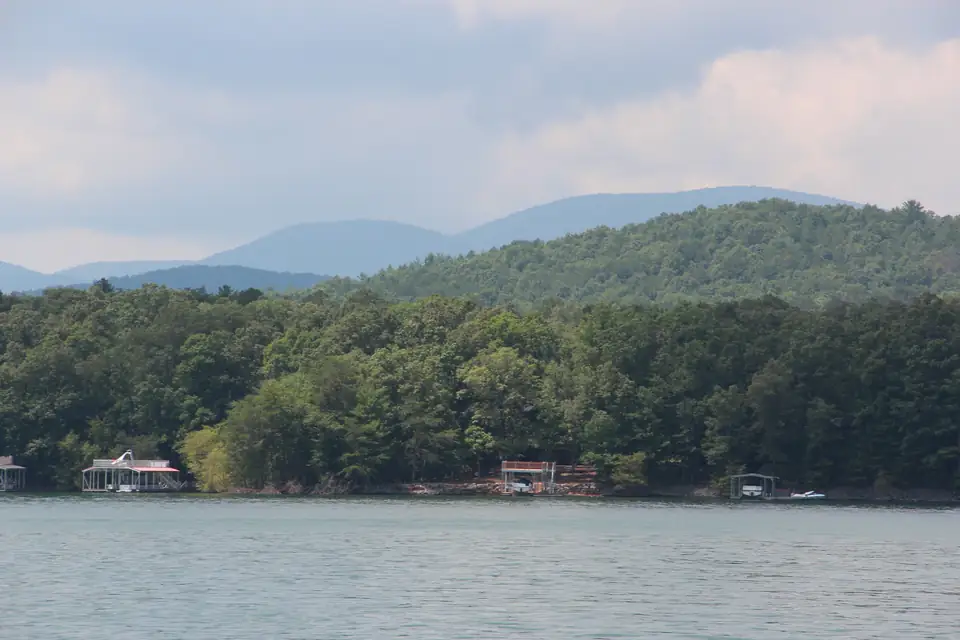
TVA gives the lake’s size as 3,290 acres (TVA), and the Forest Service and Georgia DNR use the same number. The Forest Service’s Recreation.gov listing says about 25 percent of the shoreline is developed and the rest is national forest land (USFS / Recreation.gov). That is why so much of what you see from the water is wooded. For what that means if you own or want a lakefront lot, read who owns the Lake Blue Ridge shoreline.
Public access points
Here is every public spot on the water we could source, with the agency or operator that publishes it. Fees and hours are per each source, checked October 2026.
- Lake Blue Ridge Recreation Area (USFS). A free, year-round Forest Service site on the west side of the lake with motorized boat access and day hikes, but no drinking water (USFS). It has no pin because we found no official coordinates for it.
- Blue Ridge Dam overlook and picnic area (TVA). TVA lists a scenic overlook above the dam and a shaded picnic area near the powerhouse (TVA). It shares the dam’s pin.
- Lake Blue Ridge Marina (private). At 335 Marina Dr. in Blue Ridge, it rents pontoons, kayaks, canoes and paddleboards and sells fuel (Lake Blue Ridge Marina).
- Lakewood Landing Boat Launch (USFS). A launch on the north side of the lake, open sunrise to sunset, with a launch pass required and no swimming from the dock or ramp (Recreation.gov).
- Morganton Point Recreation Area (USFS). The lake’s only developed campground, with the one designated swimming area and a $5 trailer launch (USFS).
Our guides go deeper on each one: boat ramps and the marina, where you can swim and camping at Morganton Point.
Off the map: downstream and upstream
Downstream. Below the dam the Toccoa River flows northwest into Tennessee, where it is called the Ocoee River (TVA). On the way it passes Mineral Bluff and reaches McCaysville, which shares a downtown with Copperhill, Tennessee. TVA runs a canoe and kayak launch below the dam, and Georgia DNR stocks this tailwater with trout. TVA’s instruction for anyone near the river who hears the dam sirens or sees rapidly rising water is to get off the river to high ground immediately (TVA).
Upstream. South of the lake, the Toccoa runs past Sandy Bottoms, the take-out for the 13.8-mile Toccoa River Canoe Trail (USFS). Georgia DNR’s Delayed Harvest trout section runs from Shallowford Bridge down to Sandy Bottoms. It is upstream of the lake, not below the dam. Both stretches are covered in our Toccoa River guide.
The dam itself. TVA places the dam near the Mineral Bluff community, about two miles northeast of the city of Blue Ridge (TVA). Our Blue Ridge Dam page covers its history, the overlook and the siren system.
Questions people ask
Where is Lake Blue Ridge?
Lake Blue Ridge, TVA's Blue Ridge Reservoir, is on the Toccoa River in Fannin County in north Georgia. TVA says it stretches 11 miles southeast from Blue Ridge Dam.
Source: TVA, checked Oct 18, 2026
How big is Lake Blue Ridge?
TVA gives the reservoir's size as 3,290 acres. The Forest Service and Georgia DNR use the same figure.
Source: TVA, checked Oct 18, 2026
How many miles of shoreline does Lake Blue Ridge have?
TVA says the lake has 65 miles of shoreline and that the Chattahoochee National Forest borders roughly 80 percent of it.
Source: TVA, checked Oct 18, 2026
How much of the Lake Blue Ridge shoreline is developed?
The Forest Service's Recreation.gov listing says 25 percent of the 65-mile shoreline is developed and the rest is Chattahoochee National Forest land.
Source: USFS / Recreation.gov, checked Oct 18, 2026
Where is Blue Ridge Dam?
TVA places the dam on the Toccoa River in Fannin County, Georgia, near the Mineral Bluff community and about two miles northeast of the city of Blue Ridge.
Source: TVA, checked Oct 18, 2026