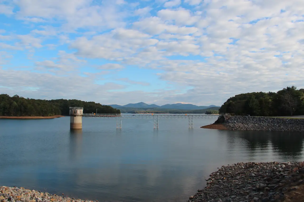
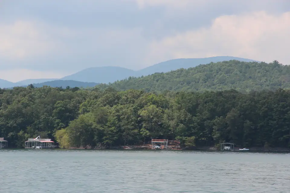
They are two different trout waters on the same river, and they sit on opposite ends of Lake Blue Ridge (TVA’s Blue Ridge Reservoir) in Fannin County, Georgia. The Toccoa tailwater runs below Blue Ridge Dam, downstream toward McCaysville, and Georgia DNR stocks it with rainbow and brown trout. The Delayed Harvest section is upstream of the lake, between Shallowford Bridge on Aska Road and the Sandy Bottoms Canoe Access, per DNR’s section map. It is not below the dam.
Mixing the two up sends anglers to the wrong water in the wrong season. Here is how they differ, with each fact from DNR, TVA or the Forest Service.
Side by side
| Toccoa tailwater | Toccoa Delayed Harvest section | |
|---|---|---|
| Where | Below Blue Ridge Dam, downstream toward McCaysville and the Tennessee line | Upstream of the lake, from Shallowford Bridge (Aska Road) to the Sandy Bottoms Canoe Access |
| Trout | Rainbow and brown trout stocked every year by DNR; most run 8 to 12 inches | One of Georgia’s Delayed Harvest streams (DNR) |
| Season to know | Water rises fast when TVA generates power | Delayed Harvest season begins Nov. 1; check DNR for the end date |
| Water | Controlled by releases from the dam; a Class I-II float when TVA generates | River above the lake; Sandy Bottoms is the take-out for the 13.8-mile Toccoa River Canoe Trail |
| Access in our sources | TVA’s canoe and kayak launch below the dam | Toccoa River – Sandy Bottoms Recreation Area (USFS), south of Blue Ridge off Aska Road |
| Safety | Dam-warning sirens: get off the river to high ground if they sound | Upstream of the lake and of Blue Ridge Dam’s releases |
| License | Georgia fishing license plus trout license, 16 and older | Georgia fishing license plus trout license, 16 and older |
The tailwater below Blue Ridge Dam
Downstream of the dam, DNR calls the Toccoa “an excellent destination for both new and seasoned trout anglers because of its high catch rates,” per its trout page. DNR stocks rainbow and brown trout there every year, and most fish run 8 to 12 inches, with a chance at a fish over 20 inches.
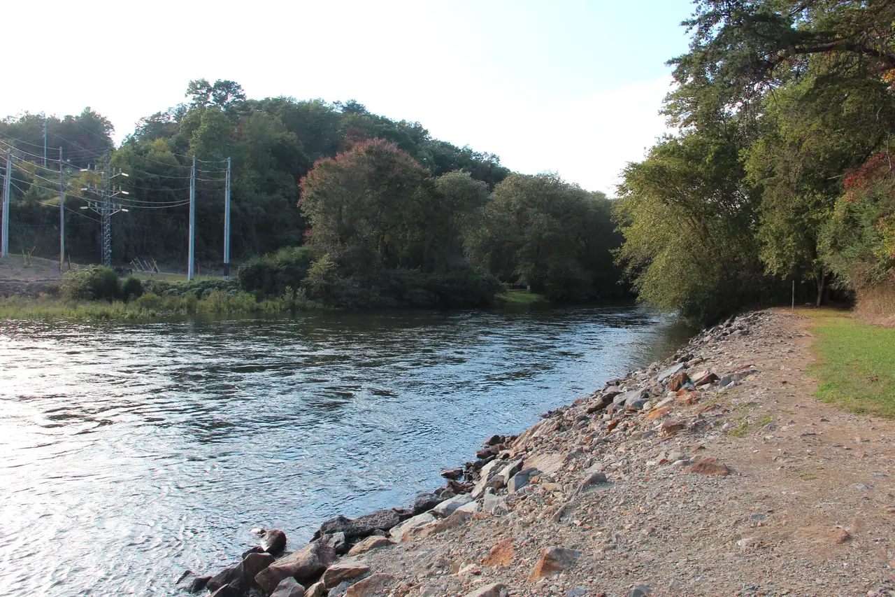
TVA has a canoe and kayak launch below the dam that gives nonmotorized boaters access to the river. When the dam releases water to generate power, the Toccoa becomes a Class I-II float, per TVA. From there the river flows northwest into Tennessee, where it is called the Ocoee River; the name changes at the state line between McCaysville and Copperhill. Our Toccoa River page and McCaysville guide cover the towns and access along the way.
When the sirens sound
Water below the dam can rise quickly when TVA generates. In March 2022 TVA placed dam-warning sirens in Tammen Park, in Mineral Bluff, on Toccoa River Forrest Road and in McCaysville, and it tests them every year (TVA). TVA’s instruction is plain: if you hear the sirens, feel a severe earthquake or see rapidly rising water, get off the river to high ground immediately.
Before you wade, pick your way out. Keep an eye on the water around your legs and on the bank you would climb, and leave at the first sign of rising water rather than waiting to be sure.
TVA's instruction for anyone near the river who hears the sirens, feels a severe earthquake or sees rapidly rising water is to get off the river to high ground immediately. (TVA, checked Oct 18, 2026)
The Delayed Harvest section upstream of the lake
Georgia’s Delayed Harvest trout season begins Nov. 1, and the Toccoa River is one of the Delayed Harvest streams, per GA DNR. DNR’s map of the Toccoa section puts it upstream of Lake Blue Ridge, between Shallowford Bridge on Aska Road and the Sandy Bottoms Canoe Access.
Toccoa River – Sandy Bottoms Recreation Area is a small, rustic Forest Service campground south of Blue Ridge off Aska Road. It sits at the lower end of the Delayed Harvest section and is the take-out for the 13.8-mile Toccoa River Canoe Trail, per Recreation.gov. It has one vault toilet and no running water or hookups.
Two things we could not verify: the date the Delayed Harvest season ends, and the section’s special tackle and harvest rules. Check DNR’s current trout regulations for both before you fish.
Above the dam the rest of the year
TVA’s history page says the Toccoa above Blue Ridge Dam is stocked with trout every other week during trout season, which runs from late March to October (TVA). That is TVA’s description. For current stocking information, check Georgia DNR’s trout pages.
The lake between the two river sections is its own trout water too. DNR says it is the only large reservoir in Georgia stocked with rainbow trout. Our rainbow trout in Lake Blue Ridge guide covers it.
Why the mix-up matters
Some guides place the Delayed Harvest stretch “below the dam.” DNR’s map does not. If you drive to the tailwater in November expecting Delayed Harvest water, you will be fishing a different stretch, stocked on its own program and shaped by dam releases and sirens. If you head for Aska Road expecting the tailwater, you will be upstream of the lake entirely. The two are on opposite sides of an 11-mile reservoir, so the choice decides which end of the county you drive to.
Which one fits your trip
- The tailwater suits a trip built around the dam and the towns downstream. You can see the dam from TVA’s overlook, eat at the picnic area near the powerhouse and launch a canoe or kayak below the dam. Expect water that changes with TVA’s generation.
- The Delayed Harvest section suits a trip south of Blue Ridge from Nov. 1. Sandy Bottoms camping is $8 per night per site, per Recreation.gov, checked October 2026, and Deep Hole Recreation Area, another small Forest Service campground on the upper Toccoa, offers camping, canoeing and fishing. The Forest Service’s Aska Trail System, with about 17 miles of trails off Aska Road (USFS), is nearby for the hours you are not fishing.
Licenses for both
In Georgia, anglers 16 and older need both a fishing license and a trout license to fish for trout, on either water (GA DNR). Both are sold at GoOutdoorsGeorgia.com. Our fishing page covers the lake and both rivers together.
Dam
Blue Ridge Dam (TVA)
TVA earthen dam built 1925-1930 by the Toccoa Electric Power Company and bought by TVA in 1939; 175 ft high and 1,553 ft long, with one 16-MW generating unit. TVA says the dam is safe for normal operations; a safety study is scheduled to finish in 2026 and TVA reports no active plans to change seasonal lake levels (as of its July 2026 page).
- Toccoa River near Mineral Bluff, about two miles northeast of the city of Blue Ridge (Fannin County, Georgia)
Source: Tennessee Valley Authority, checked Oct 18, 2026
Boat ramp Not yet confirmed
Toccoa River canoe and kayak launch below Blue Ridge Dam (TVA)
TVA's launch below the dam gives nonmotorized boaters access to the Toccoa River, which becomes a Class I-II float when the dam is generating. The dam has a siren warning system: if you hear sirens or see rapidly rising water, get off the river to high ground.
- Toccoa River below Blue Ridge Dam (Fannin County, Georgia)
Source: Tennessee Valley Authority, checked Oct 18, 2026
Campground
Toccoa River – Sandy Bottoms Recreation Area (USFS)
A small rustic Forest Service campground on the Toccoa River upstream of the lake, south of Blue Ridge off Aska Road. It is the take-out for the 13.8-mile Toccoa River Canoe Trail and sits at the lower end of the Toccoa Delayed Harvest trout section. There is one vault toilet and no running water or hookups.
- $8 per night per site (Recreation.gov)
- 7406 Old Dial Road, Blue Ridge, GA 30513 (Fannin County, Georgia)
Source: Recreation.gov (USDA Forest Service), checked Oct 18, 2026
Fishing
Toccoa River Delayed Harvest trout section (GA DNR)
Georgia DNR's Delayed Harvest stretch of the Toccoa, upstream of Lake Blue Ridge (not below the dam). The DH season begins Nov. 1. Anglers 16 and older need a Georgia fishing license and a trout license.
- Delayed Harvest season begins Nov. 1
- Georgia fishing + trout license
- Toccoa River between Shallowford Bridge (Aska Road) and Sandy Bottoms Canoe Access (Fannin County, Georgia)
Source: Georgia DNR Wildlife Resources Division, checked Oct 18, 2026
Fishing
Toccoa River tailwater below Blue Ridge Dam (trout)
Georgia DNR stocks rainbow and brown trout in the Toccoa below the dam every year and calls it an excellent destination because of high catch rates. Most fish are 8-12 inches, with a chance at a fish over 20 inches. Water levels change fast when TVA generates, so heed the dam's siren warning system.
- Georgia fishing + trout license (16+)
- Toccoa River downstream of Blue Ridge Dam toward McCaysville (Fannin County, Georgia)
Source: Georgia DNR Wildlife Resources Division, checked Oct 18, 2026
Trail Not yet confirmed
Toccoa River Swinging Bridge (Benton MacKaye Trail, USFS)
The Benton MacKaye Trail crosses the Toccoa River on a suspension bridge reached from Georgia 60, upstream of the lake. The Forest Service's recreation.gov text gives its length as 260 feet; other sources say 270, so avoid quoting a single number without attribution.
- Benton MacKaye Trail over the Toccoa River, reached from Georgia 60 (Fannin County, Georgia)
Source: Recreation.gov (USDA Forest Service), checked Oct 18, 2026
Campground
Deep Hole Recreation Area (USFS)
A small Forest Service campground on a big bend of the upper Toccoa River, upstream of the lake, offering camping, canoeing and fishing. Camping is $15 a night by reservation on Recreation.gov, and day use is $5 per vehicle. A Georgia fishing license and trout license are required.
- Year round
- Camping $15/site/night; day use $5/vehicle
- Forest Service Road 654 off Georgia 60, north of Suches (Fannin County, Georgia per OSM)
Source: USDA Forest Service, checked Oct 18, 2026
Questions people ask
Where exactly is the Toccoa Delayed Harvest section?
No. Georgia DNR's map puts the Toccoa River Delayed Harvest section upstream of Lake Blue Ridge, between Shallowford Bridge (Aska Road) and the Sandy Bottoms Canoe Access. Below the dam is the tailwater, a separate stocked fishery.
Source: GA DNR, checked Oct 18, 2026
When does the Toccoa Delayed Harvest season end?
We could not verify the end date, so check Georgia DNR's current regulations. What DNR does confirm is the start: Georgia's Delayed Harvest season begins Nov. 1, and the Toccoa is one of the Delayed Harvest streams.
Source: GA DNR, checked Oct 18, 2026
What trout are in the Toccoa tailwater below Blue Ridge Dam?
Georgia DNR stocks rainbow and brown trout below the dam every year. It calls the tailwater a high-catch-rate stream, and most fish run 8 to 12 inches.
Source: GA DNR, checked Oct 18, 2026
Where are the Blue Ridge Dam warning sirens?
In March 2022 TVA placed dam-warning sirens in Tammen Park, in Mineral Bluff, on Toccoa River Forrest Road and in McCaysville, and it tests them every year. If they sound, TVA says to get off the river to high ground immediately.
Source: TVA, checked Oct 18, 2026
Written by the Visit Lake Blue Ridge Editorial Team. AI tools help us draft; people check every fact before it publishes.